
Cologne topographic map
Interactive map
Click on the map to display elevation.
About this map
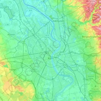
Name: Cologne topographic map, elevation, terrain.
Location: Cologne, North Rhine – Westphalia, Germany (50.83044 6.77253 51.08497 7.16203)
Average elevation: 226 ft
Minimum elevation: 105 ft
Maximum elevation: 748 ft