
Shillong topographic map
Interactive map
Click on the map to display elevation.
About this map
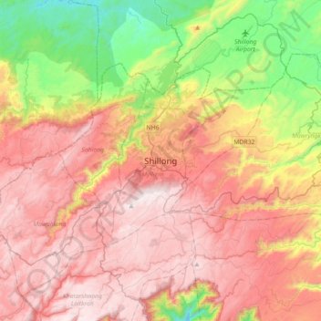
Name: Shillong topographic map, elevation, terrain.
Location: Shillong, Mylliem, East Khasi Hills, Meghalaya, 793001, India (25.41604 91.72253 25.73604 92.04253)
Average elevation: 4,432 ft
Minimum elevation: 2,152 ft
Maximum elevation: 6,421 ft