
Mashhad topographic map
Interactive map
Click on the map to display elevation.
About this map
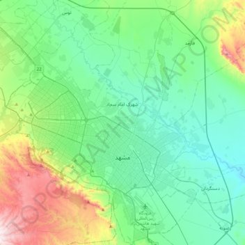
Name: Mashhad topographic map, elevation, terrain.
Average elevation: 3,517 ft
Minimum elevation: 2,920 ft
Maximum elevation: 5,525 ft
Other topographic maps
Click on a map to view its topography, its elevation and its terrain.
Shahid Razavi
Iran > Razavi Khorasan > Mashhad County > Mashhad
Shahid Razavi, Quarter 1 of District 11, District 11, Mashhad, بخش مرکزی شهرستان مشهد, Mashhad County, Razavi Khorasan, Iran
Average elevation: 3,438 ft