
Iringa topographic map
Interactive map
Click on the map to display elevation.
About this map
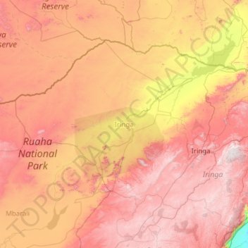
Name: Iringa topographic map, elevation, terrain.
Location: Iringa, Iringa Region, Southern Highlands Zone, Tanzania (-8.24409 34.19411 -6.88860 36.20176)
Average elevation: 3,986 ft
Minimum elevation: 846 ft
Maximum elevation: 7,579 ft
Other topographic maps
Click on a map to view its topography, its elevation and its terrain.
Isagwa
Tanzania > Iringa Region > Isagwa
Isagwa, Kilolo, Iringa Region, Southern Highlands Zone, Tanzania
Average elevation: 4,705 ft
Kilosa
Kilosa, Mufindi, Iringa Region, Southern Highlands Zone, Tanzania
Average elevation: 5,292 ft