
Emerald Isle topographic map
Interactive map
Click on the map to display elevation.
About this map
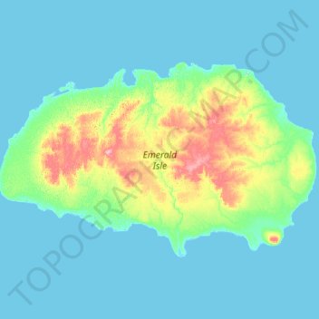
Name: Emerald Isle topographic map, elevation, terrain.
Average elevation: 36 ft
Minimum elevation: -7 ft
Maximum elevation: 262 ft
Other topographic maps
Click on a map to view its topography, its elevation and its terrain.
Emerald Isle
Canada > Northwest Territories > Inuvik Region
Emerald Isle, Inuvik Region, Northwest Territories, Canada
Average elevation: 36 ft