
Chalco topographic map
Interactive map
Click on the map to display elevation.
About this map
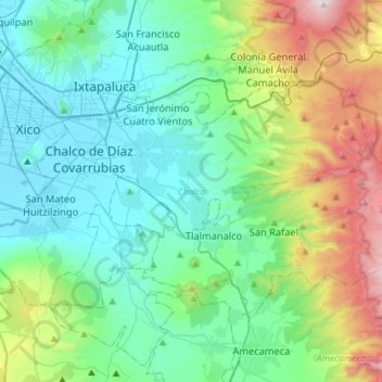
Name: Chalco topographic map, elevation, terrain.
Location: Chalco, State of Mexico, Mexico (19.15738 -98.96968 19.31923 -98.68289)
Average elevation: 8,707 ft
Minimum elevation: 7,303 ft
Maximum elevation: 13,314 ft