
Distrikt Nickerie topographic map
Interactive map
Click on the map to display elevation.
About this map
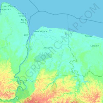
Name: Distrikt Nickerie topographic map, elevation, terrain.
Location: Distrikt Nickerie, Nickerie, Suriname (4.96667 -57.53333 6.36667 -56.13333)
Average elevation: 39 ft
Minimum elevation: -7 ft
Maximum elevation: 351 ft