
Kemmel topographic map
Interactive map
Click on the map to display elevation.
About this map
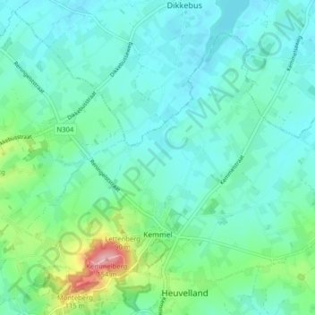
Name: Kemmel topographic map, elevation, terrain.
Average elevation: 161 ft
Minimum elevation: 75 ft
Maximum elevation: 502 ft
Other topographic maps
Click on a map to view its topography, its elevation and its terrain.
Wijtschate
Belgium > West Flanders > Ieper > Heuvelland
Wijtschate, Heuvelland, Ieper, West Flanders, Flanders, 8953, Belgium
Average elevation: 138 ft
Westouter
Belgium > West Flanders > Ieper > Heuvelland
Westouter, Heuvelland, Ieper, West Flanders, Flanders, 8954, Belgium
Average elevation: 194 ft
Loker
Belgium > West Flanders > Ieper > Heuvelland
Loker, Heuvelland, Ieper, West Flanders, Flanders, 8958, Belgium
Average elevation: 240 ft