
Mamoudzou topographic map
Interactive map
Click on the map to display elevation.
About this map
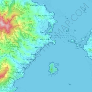
Name: Mamoudzou topographic map, elevation, terrain.
Location: Mamoudzou, Mayotte, France (-12.82228 45.15255 -12.75277 45.25116)
Average elevation: 194 ft
Minimum elevation: -3 ft
Maximum elevation: 1,804 ft