ချင်းတွင်းမြစ် topographic map
Interactive map
Click on the map to display elevation.
About this map
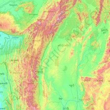
Name: ချင်းတွင်းမြစ် topographic map, elevation, terrain.
Average elevation: 1,775 ft
Minimum elevation: 0 ft
Maximum elevation: 11,378 ft

Click on the map to display elevation.
Name: ချင်းတွင်းမြစ် topographic map, elevation, terrain.
Average elevation: 1,775 ft
Minimum elevation: 0 ft
Maximum elevation: 11,378 ft