
Muthkuru topographic map
Interactive map
Click on the map to display elevation.
About this map
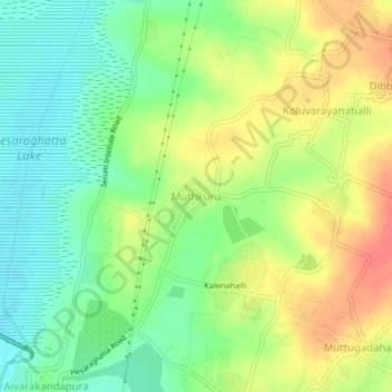
Name: Muthkuru topographic map, elevation, terrain.
Location: Muthkuru, Bangalore Urban, Karnataka, India (13.13663 77.48866 13.17663 77.52866)
Average elevation: 2,871 ft
Minimum elevation: 2,792 ft
Maximum elevation: 2,963 ft