
御蔵島 topographic map
Interactive map
Click on the map to display elevation.
About this map
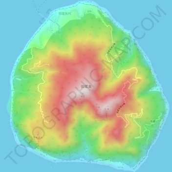
Name: 御蔵島 topographic map, elevation, terrain.
Location: 御蔵島, 御蔵島村, 三宅支庁, Tokyo, Kantō, Japon (33.85168 139.57658 33.90116 139.63207)
Average elevation: 853 ft
Minimum elevation: 0 ft
Maximum elevation: 2,726 ft