
Tagula topographic map
Interactive map
Click on the map to display elevation.
About this map
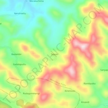
Name: Tagula topographic map, elevation, terrain.
Location: Tagula, Visakhapatnam, Andhra Pradesh, India (18.28978 82.47474 18.32978 82.51474)
Average elevation: 3,209 ft
Minimum elevation: 2,671 ft
Maximum elevation: 3,894 ft