
Wilton topographic map
Interactive map
Click on the map to display elevation.
About this map
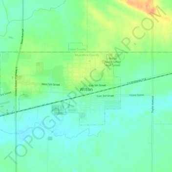
Name: Wilton topographic map, elevation, terrain.
Location: Wilton, Muscatine County, Iowa, USA (41.57988 -91.05746 41.59943 -91.00522)
Average elevation: 689 ft
Minimum elevation: 646 ft
Maximum elevation: 768 ft