
Burnham topographic map
Interactive map
Click on the map to display elevation.
About this map
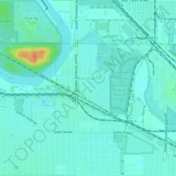
Name: Burnham topographic map, elevation, terrain.
Location: Burnham, Cook County, Illinois, USA (41.62993 -87.56407 41.64467 -87.52495)
Average elevation: 591 ft
Minimum elevation: 564 ft
Maximum elevation: 709 ft