
Rocky Butte topographic map
Interactive map
Click on the map to display elevation.
About this map
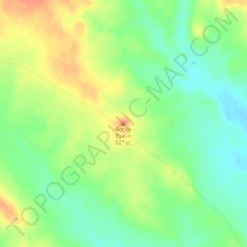
Name: Rocky Butte topographic map, elevation, terrain.
Location: Rocky Butte, Perkins County, South Dakota, United States (45.19160 -102.74882 45.19170 -102.74872)
Average elevation: 2,628 ft
Minimum elevation: 2,559 ft
Maximum elevation: 2,703 ft
Other topographic maps
Click on a map to view its topography, its elevation and its terrain.
Bison
United States > South Dakota > Perkins County
Bison, Perkins County, South Dakota, 57620, United States
Average elevation: 2,779 ft
Badlands
United States > South Dakota > Perkins County
Badlands, Perkins County, South Dakota, United States
Average elevation: 2,713 ft