
Sant Llorenç de Morunys topographic map
Interactive map
Click on the map to display elevation.
About this map
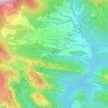
Name: Sant Llorenç de Morunys topographic map, elevation, terrain.
Average elevation: 3,199 ft
Minimum elevation: 2,526 ft
Maximum elevation: 4,656 ft
Other topographic maps
Click on a map to view its topography, its elevation and its terrain.
Sant Llorenç de Morunys
Spain > Catalonia > Solsonès > Sant Llorenç de Morunys > Sant Llorenç de Morunys
Sant Llorenç de Morunys, Solsonès, Lleida, Catalonia, 258282, Spain
Average elevation: 3,369 ft