
Midway Island topographic map
Interactive map
Click on the map to display elevation.
About this map
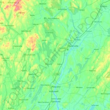
Name: Midway Island topographic map, elevation, terrain.
Average elevation: 351 ft
Minimum elevation: -3 ft
Maximum elevation: 2,090 ft
Other topographic maps
Click on a map to view its topography, its elevation and its terrain.
Messalonskee Lake
United States > Maine > Kennebec County > Belgrade
Messalonskee Lake, Belgrade, Kennebec County, Maine, United States
Average elevation: 295 ft