
Saugatuck Reservoir topographic map
Interactive map
Click on the map to display elevation.
About this map
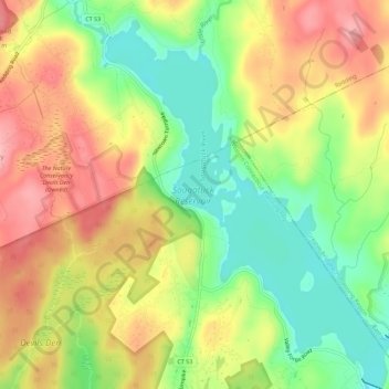
Name: Saugatuck Reservoir topographic map, elevation, terrain.
Average elevation: 430 ft
Minimum elevation: 226 ft
Maximum elevation: 630 ft
Other topographic maps
Click on a map to view its topography, its elevation and its terrain.
Pop Mountain
USA > Connecticut > Weston
Pop Mountain, Weston, Fairfield, Connecticut, 06883, USA
Average elevation: 328 ft