
Shadrinsk topographic map
Interactive map
Click on the map to display elevation.
About this map
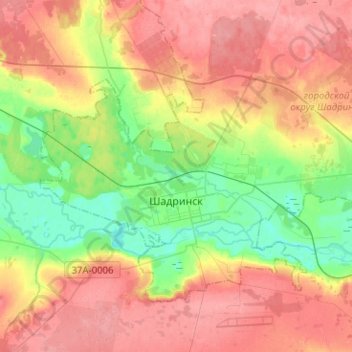
Name: Shadrinsk topographic map, elevation, terrain.
Location: Shadrinsk, Kurgan Oblast, Ural Federal District, Russia (56.05146 63.53206 56.14291 63.78418)
Average elevation: 361 ft
Minimum elevation: 220 ft
Maximum elevation: 489 ft