
Cibitoke topographic map
Interactive map
Click on the map to display elevation.
About this map
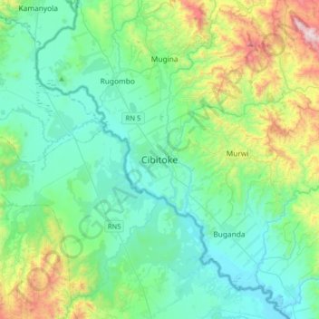
Name: Cibitoke topographic map, elevation, terrain.
Location: Cibitoke, Burundi (-3.05192 28.96441 -2.73192 29.28441)
Average elevation: 3,596 ft
Minimum elevation: 2,608 ft
Maximum elevation: 7,218 ft