
Blackstone topographic map
Interactive map
Click on the map to display elevation.
About this map
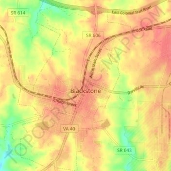
Name: Blackstone topographic map, elevation, terrain.
Location: Blackstone, Nottoway County, Virginia, United States (37.05667 -78.02243 37.10726 -77.97998)
Average elevation: 400 ft
Minimum elevation: 279 ft
Maximum elevation: 466 ft