
Gent-Brugge-Oostende topographic map
Interactive map
Click on the map to display elevation.
About this map
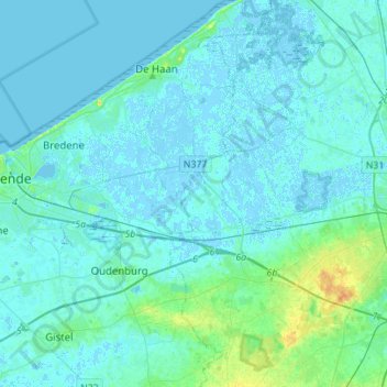
Name: Gent-Brugge-Oostende topographic map, elevation, terrain.
Average elevation: 10 ft
Minimum elevation: -10 ft
Maximum elevation: 85 ft
Other topographic maps
Click on a map to view its topography, its elevation and its terrain.
Stalhille
België > Vlaanderen > Jabbeke
Stalhille, Jabbeke, Brugge, West-Vlaanderen, Vlaanderen, 8490, België
Average elevation: 3 ft