
Sevier topographic map
Interactive map
Click on the map to display elevation.
About this map
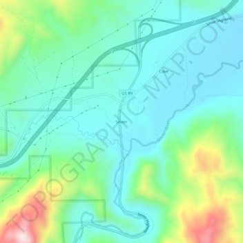
Name: Sevier topographic map, elevation, terrain.
Location: Sevier, Sevier County, Utah, 84766, USA (38.56636 -112.27826 38.60636 -112.23826)
Average elevation: 5,863 ft
Minimum elevation: 5,472 ft
Maximum elevation: 7,054 ft