
Bataille de Roncevaux (778) (aprox.) topographic map
Interactive map
Click on the map to display elevation.
About this map
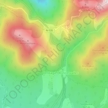
Name: Bataille de Roncevaux (778) (aprox.) topographic map, elevation, terrain.
Average elevation: 3,389 ft
Minimum elevation: 2,631 ft
Maximum elevation: 4,337 ft
Other topographic maps
Click on a map to view its topography, its elevation and its terrain.
Col d'Ibañeta
Espagne > Navarre > Pirinioak / Pirineo > Roncevaux
Col d'Ibañeta, Roncevaux, Pirinioak / Pirineo, Navarre, 31650, Espagne
Average elevation: 3,383 ft