
Pampa topographic map
Interactive map
Click on the map to display elevation.
About this map
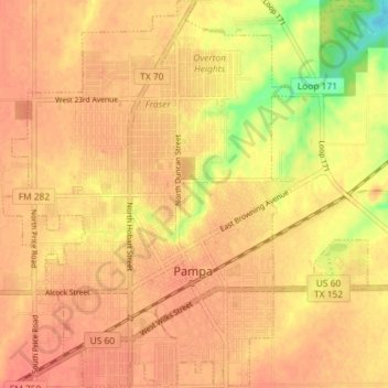
Name: Pampa topographic map, elevation, terrain.
Location: Pampa, Gray County, Texas, 79065, United States (35.51855 -100.99568 35.57719 -100.92760)
Average elevation: 3,225 ft
Minimum elevation: 3,110 ft
Maximum elevation: 3,261 ft
Other topographic maps
Click on a map to view its topography, its elevation and its terrain.
Alanreed
United States > Texas > Gray County
Alanreed, Gray County, Texas, 79002, United States
Average elevation: 2,966 ft
McLean
United States > Texas > Gray County
McLean, Gray County, Texas, 79057, United States
Average elevation: 2,864 ft