
Maghar topographic map
Interactive map
Click on the map to display elevation.
About this map
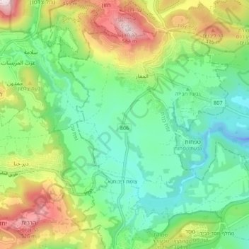
Name: Maghar topographic map, elevation, terrain.
Location: Maghar, Kinneret Subdistrict, North District, Israel (32.84662 35.37910 32.89984 35.46195)
Average elevation: 653 ft
Minimum elevation: -128 ft
Maximum elevation: 1,942 ft