
Heron Island topographic map
Interactive map
Click on the map to display elevation.
About this map
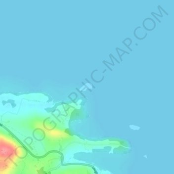
Name: Heron Island topographic map, elevation, terrain.
Average elevation: 154 ft
Minimum elevation: 135 ft
Maximum elevation: 404 ft
Other topographic maps
Click on a map to view its topography, its elevation and its terrain.
Belcoo
United Kingdom > Northern Ireland > County Fermanagh
Belcoo, County Fermanagh, Ulster, Northern Ireland, BT93 5FB, United Kingdom
Average elevation: 282 ft
Moher
United Kingdom > Northern Ireland > County Fermanagh
Moher, Lea, County Fermanagh, Ulster, Northern Ireland, BT92 4FJ, United Kingdom
Average elevation: 213 ft
Tempo
United Kingdom > Northern Ireland > County Fermanagh
Tempo, County Fermanagh, Ulster, Northern Ireland, BT94 3LU, United Kingdom
Average elevation: 417 ft
Horse Island
United Kingdom > Northern Ireland > County Fermanagh
Horse Island, County Fermanagh, Ulster, Northern Ireland, United Kingdom
Average elevation: 151 ft