
Hedges-Boyer Park topographic map
Interactive map
Click on the map to display elevation.
About this map
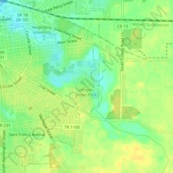
Name: Hedges-Boyer Park topographic map, elevation, terrain.
Average elevation: 781 ft
Minimum elevation: 738 ft
Maximum elevation: 810 ft
Other topographic maps
Click on a map to view its topography, its elevation and its terrain.
WHEI-FM (Tiffin)
United States > Ohio > Tiffin
WHEI-FM (Tiffin), East Perry Street, Tiffin, Clinton Township, Seneca County, Ohio, 44883, United States
Average elevation: 764 ft