
Wallingford topographic map
Interactive map
Click on the map to display elevation.
About this map
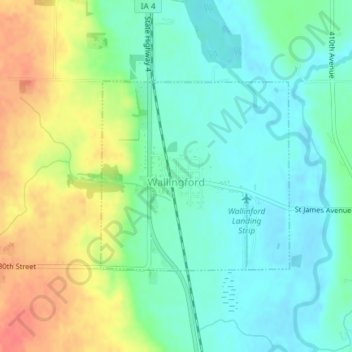
Name: Wallingford topographic map, elevation, terrain.
Location: Wallingford, Emmet County, Iowa, United States (43.31300 -94.80216 43.32757 -94.78221)
Average elevation: 1,302 ft
Minimum elevation: 1,237 ft
Maximum elevation: 1,421 ft