
Dupree topographic map
Interactive map
Click on the map to display elevation.
About this map
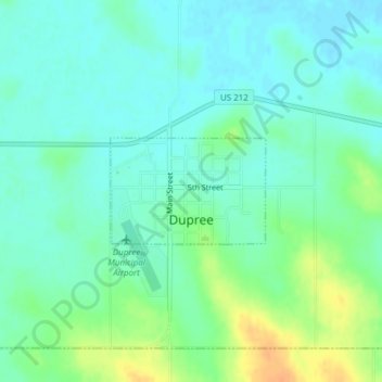
Name: Dupree topographic map, elevation, terrain.
Location: Dupree, Ziebach County, South Dakota, 57632, United States (45.04571 -101.60908 45.05325 -101.59353)
Average elevation: 2,382 ft
Minimum elevation: 2,346 ft
Maximum elevation: 2,457 ft