
Hasselt topographic map
Interactive map
Click on the map to display elevation.
About this map
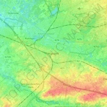
Name: Hasselt topographic map, elevation, terrain.
Location: Hasselt, Limburg, Flanders, Belgium (50.88304 5.27968 50.97784 5.41494)
Average elevation: 128 ft
Minimum elevation: 66 ft
Maximum elevation: 223 ft