
Terrebonne topographic map
Interactive map
Click on the map to display elevation.
About this map
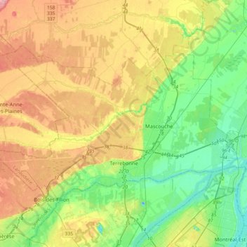
Name: Terrebonne topographic map, elevation, terrain.
Location: Terrebonne, Les Moulins, Lanaudière, Quebec, Canada (45.66872 -73.84478 45.82716 -73.48708)
Average elevation: 135 ft
Minimum elevation: -62 ft
Maximum elevation: 328 ft
Other topographic maps
Click on a map to view its topography, its elevation and its terrain.
Mascouche
Canada > Quebec > Les Moulins
Mascouche, Les Moulins, Lanaudière, Quebec, Canada
Average elevation: 118 ft