
River Bluff topographic map
Interactive map
Click on the map to display elevation.
About this map
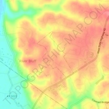
Name: River Bluff topographic map, elevation, terrain.
Location: River Bluff, Oldham County, Kentucky, United States (38.36649 -85.60877 38.37798 -85.59719)
Average elevation: 591 ft
Minimum elevation: 436 ft
Maximum elevation: 679 ft