
Wallingford topographic map
Interactive map
Click on the map to display elevation.
About this map
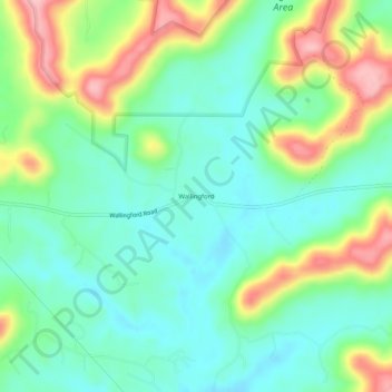
Name: Wallingford topographic map, elevation, terrain.
Location: Wallingford, Fleming County, Kentucky, 41093, United States (38.38508 -83.63214 38.42508 -83.59214)
Average elevation: 889 ft
Minimum elevation: 728 ft
Maximum elevation: 1,211 ft
Other topographic maps
Click on a map to view its topography, its elevation and its terrain.
Hillsboro
United States > Kentucky > Fleming County
Hillsboro, Fleming County, Kentucky, United States
Average elevation: 833 ft
Elizaville
United States > Kentucky > Fleming County
Elizaville, Fleming County, Kentucky, 41039, United States
Average elevation: 902 ft
Ewing
United States > Kentucky > Fleming County
Ewing, Fleming County, Kentucky, United States
Average elevation: 915 ft
Flemingsburg
United States > Kentucky > Fleming County
Flemingsburg, Fleming County, Kentucky, United States
Average elevation: 879 ft