
Purwodiningratan topographic map
Interactive map
Click on the map to display elevation.
About this map
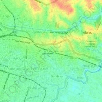
Name: Purwodiningratan topographic map, elevation, terrain.
Location: Purwodiningratan, Surakarta, Central Java, 57137, Indonesia (-7.58234 110.82090 -7.54234 110.86090)
Average elevation: 322 ft
Minimum elevation: 262 ft
Maximum elevation: 410 ft