
Demodara topographic map
Interactive map
Click on the map to display elevation.
About this map
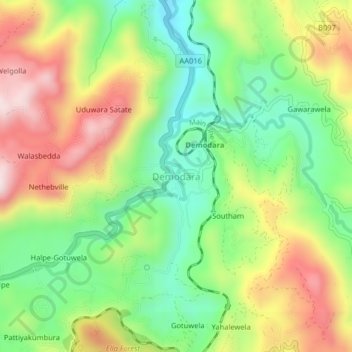
Name: Demodara topographic map, elevation, terrain.
Location: Demodara, Badulla District, Uva Province, 90122, Sri Lanka (6.87818 81.03964 6.91818 81.07964)
Average elevation: 3,268 ft
Minimum elevation: 2,602 ft
Maximum elevation: 4,134 ft
Other topographic maps
Click on a map to view its topography, its elevation and its terrain.
Uduwara Satate
Sri Lanka > Uva Province > Demodara > Uduwara Satate
Uduwara Satate, Demodara, Badulla District, Uva Province, 90122, Sri Lanka
Average elevation: 3,310 ft