
Howe topographic map
Interactive map
Click on the map to display elevation.
About this map
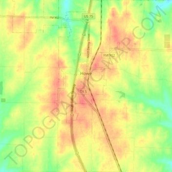
Name: Howe topographic map, elevation, terrain.
Location: Howe, Grayson County, Texas, 75459, United States (33.46537 -96.65025 33.53849 -96.59389)
Average elevation: 814 ft
Minimum elevation: 715 ft
Maximum elevation: 883 ft
Howe's elevation of 860 feet (260 m) is the highest point along US 75 between the Red River and the Gulf of Mexico.