
Riverside topographic map
Interactive map
Click on the map to display elevation.
About this map
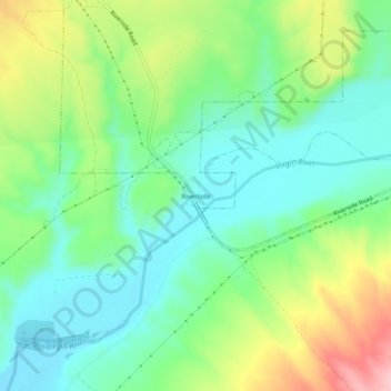
Name: Riverside topographic map, elevation, terrain.
Location: Riverside, Clark County, Nevada, United States (36.71609 -114.24053 36.75609 -114.20053)
Average elevation: 1,585 ft
Minimum elevation: 1,394 ft
Maximum elevation: 1,965 ft