
Adur topographic map
Interactive map
Click on the map to display elevation.
About this map
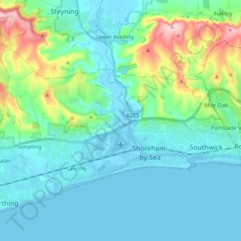
Name: Adur topographic map, elevation, terrain.
Location: Adur, West Sussex, South East, England, United Kingdom (50.81610 -0.37154 50.87475 -0.21532)
Average elevation: 131 ft
Minimum elevation: -13 ft
Maximum elevation: 702 ft