
Mount Osceola topographic map
Interactive map
Click on the map to display elevation.
About this map
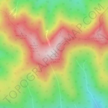
Name: Mount Osceola topographic map, elevation, terrain.
Average elevation: 3,284 ft
Minimum elevation: 2,234 ft
Maximum elevation: 4,295 ft
Other topographic maps
Click on a map to view its topography, its elevation and its terrain.
Livermore
United States > New Hampshire > Livermore
Livermore, Grafton County, New Hampshire, United States
Average elevation: 2,270 ft