
Mankato topographic map
Interactive map
Click on the map to display elevation.
About this map
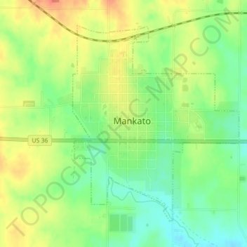
Name: Mankato topographic map, elevation, terrain.
Location: Mankato, Jewell County, Kansas, United States (39.77596 -98.21781 39.79738 -98.19411)
Average elevation: 1,768 ft
Minimum elevation: 1,686 ft
Maximum elevation: 1,854 ft
Other topographic maps
Click on a map to view its topography, its elevation and its terrain.
Lovewell
United States > Kansas > Jewell County > Lovewell
Lovewell, Jewell County, Kansas, United States
Average elevation: 1,591 ft
Burr Oak
United States > Kansas > Jewell County
Burr Oak, Jewell County, Kansas, 66936, United States
Average elevation: 1,673 ft