
Area F (Columbia Lake/Windermere Lake) topographic map
Interactive map
Click on the map to display elevation.
About this map
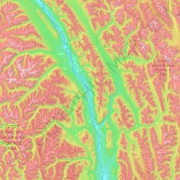
Name: Area F (Columbia Lake/Windermere Lake) topographic map, elevation, terrain.
Average elevation: 5,955 ft
Minimum elevation: 2,543 ft
Maximum elevation: 11,237 ft
Other topographic maps
Click on a map to view its topography, its elevation and its terrain.
Whiteswan Lake
Canada > British Columbia > Regional District of East Kootenay > Area F (Columbia Lake/Windermere Lake)
Whiteswan Lake, Area F (Columbia Lake/Windermere Lake), Regional District of East Kootenay, British Columbia, Canada
Average elevation: 4,567 ft
Shuswap
Canada > British Columbia > Regional District of East Kootenay > Area F (Columbia Lake/Windermere Lake)
Shuswap, Area F (Columbia Lake/Windermere Lake), Regional District of East Kootenay, British Columbia, V0A 1K3, Canada
Average elevation: 3,038 ft