
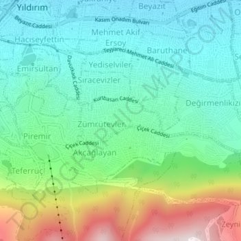
Zümrütevler Mahallesi topographic map
Interactive map
Click on the map to display elevation.
About this map
Name: Zümrütevler Mahallesi topographic map, elevation, terrain.
Location: Zümrütevler Mahallesi, Yıldırım, Bursa, Marmara Region, Turkey (40.17247 29.08753 40.17756 29.09991)
Average elevation: 1,260 ft
Minimum elevation: 522 ft
Maximum elevation: 3,100 ft