
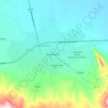
Doğubayazıt topographic map
Interactive map
Click on the map to display elevation.
About this map
Name: Doğubayazıt topographic map, elevation, terrain.
Location: Doğubayazıt, Ağrı, Eastern Anatolia Region, 04400, Turkey (39.50823 44.04049 39.58823 44.12049)
Average elevation: 5,443 ft
Minimum elevation: 4,987 ft
Maximum elevation: 7,254 ft