
Dissen topographic map
Interactive map
Click on the map to display elevation.
About this map
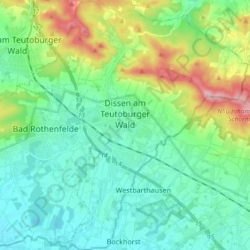
Name: Dissen topographic map, elevation, terrain.
Location: Dissen, Landkreis Osnabrück, Lower Saxony, 49201, Germany (52.07174 8.14761 52.15260 8.26791)
Average elevation: 430 ft
Minimum elevation: 246 ft
Maximum elevation: 974 ft