
Pine Lawn topographic map
Interactive map
Click on the map to display elevation.
About this map
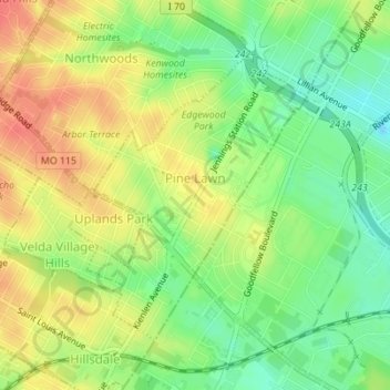
Name: Pine Lawn topographic map, elevation, terrain.
Location: Pine Lawn, Saint Louis County, Missouri, United States (38.68466 -90.28475 38.70479 -90.26520)
Average elevation: 568 ft
Minimum elevation: 476 ft
Maximum elevation: 659 ft