
Keller Farm Mitigation Bank topographic map
Interactive map
Click on the map to display elevation.
About this map
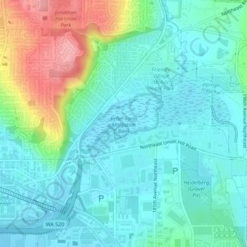
Name: Keller Farm Mitigation Bank topographic map, elevation, terrain.
Average elevation: 131 ft
Minimum elevation: 33 ft
Maximum elevation: 427 ft
Other topographic maps
Click on a map to view its topography, its elevation and its terrain.
Kenilworth
United States > Washington > Redmond > Kenilworth
Kenilworth, Redmond, King County, Washington, 98008-3439, United States
Average elevation: 217 ft