
Aguascalientes topographic map
Interactive map
Click on the map to display elevation.
About this map
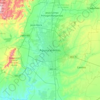
Name: Aguascalientes topographic map, elevation, terrain.
Average elevation: 6,417 ft
Minimum elevation: 5,830 ft
Maximum elevation: 8,248 ft
The Aguascalientes Bicentenary Velodrome, designed by Peter Junek, hosted the 2010 Pan American Track Championships. At an elevation of 1887m, the Velodrome is a frequent location for attempts at breaking the Cycling Hour Record.