
Pereira topographic map
Interactive map
Click on the map to display elevation.
About this map
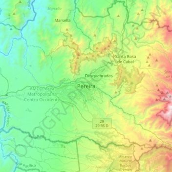
Name: Pereira topographic map, elevation, terrain.
Average elevation: 5,131 ft
Minimum elevation: 2,818 ft
Maximum elevation: 11,040 ft
Pereira is located on the central mountain range, on the Otún river valley, and part of the Cauca river valley. Pereira, like many Colombian cities, has high-elevation areas with difficult access or flat or steep parts. The streets are laid out according to the elevation of the respective zones.